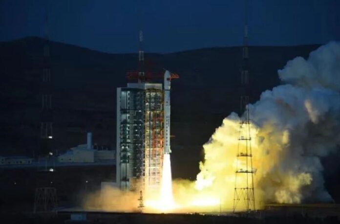
China launched a pair of cartography satellites on Thursday (March 9) to boost the country’s Earth observation and mapping capabilities.
A Long March 4C rocket lifted off into a pre-dawn sky above Taiyuan Satellite Launch Center in north China at 5:41 p.m. EST on Thursday (2241 GMT, or 6:41 a.m. Beijing time on March 10), shedding insulation tiles as it climbed.
The launch successfully sent the Tianhui 6 A and B satellites into orbit, the China Aerospace Science and Technology Corporation (CASC) — the country’s main space contractor — announced (opens in new tab) within an hour of liftoff.
Related: The latest news about China’s space program
The U.S. Space Force‘s 18th Space Defense Squadron later tracked and cataloged the satellites in roughly circular 550-mile-altitude (890 kilometers) sun-synchronous orbits.
The satellites will be used in geographic mapping, land resource surveying, scientific experiments and other tasks, according (opens in new tab) to Chinese state media.
The satellites were manufactured by Dongfanghong Satellite, a subsidiary of the China Academy of Space Technology (CAST), itself a major academy under CASC.
No details of their payloads or capabilities were published, suggesting the mission is quasi-classified and will have at least some military-related applications. The mission patch features dolphins, suggesting the satellites may be conducting ocean mapping.
The Shanghai Academy of Spaceflight Technology (SAST), another major arm of CASC, provided the three-stage, 145-foot-long (44 meters) Long March 4C rocket for the mission.
China has so far launched eight missions in 2023. Overall, the country aims to launch more than 200 spacecraft on more than 70 launches this year, despite a month-long break in activities around the Chinese New Year.
Follow us on Twitter @Spacedotcom (opens in new tab) or on Facebook (opens in new tab).

