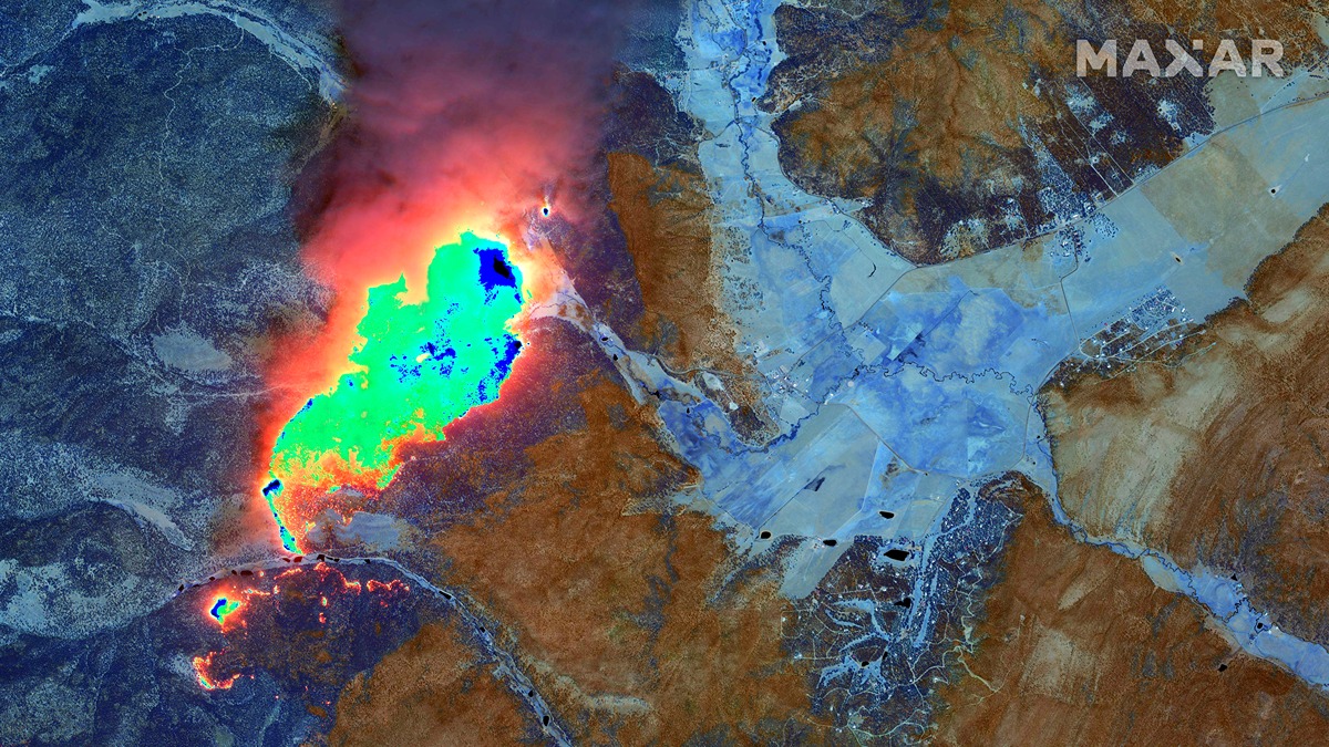
Devastating wildfires in New Mexico fueled by high winds are visible from space.
Fresh satellite images from Maxar Technologies caught a portion of the 200,000 burning acres associated with the Calf Canyon and Hermits Peak fires, east of Santa Fe. On Monday (May 9), the New York Times listed this set of New Mexico blazes as the largest active wildfire in the United States; according to a collection of state agencies, the fire was nearly 30% contained as of May 13.
Going into the observations, Maxar personnel wanted capture three types of images to view different aspects of the blaze: natural color, color infrared and shortwave infrared.
Related: Astronaut watches California wildfires spewing smoke from space (photos)
Infrared imaging allows satellites to chart the heat signature of the blaze, which can assist investigators with making predictions about the wildfire’s path. Shortwave infrared can “penetrate through the smoke and detect active fire lines and hot spots,” Maxar officials wrote. During a fire, hot spots are especially crucial to address if possible to contain the spread.
“With color infrared satellite imagery, healthy trees and vegetation appear in shades of red/pink while burned areas appear in shades of black/grey,” Maxar said of the imagery.
“With SWIR [shortwave infrared] satellite images, Maxar’s imagery sensor can penetrate through the smoke and detect active fire lines and hot spots, which appear to glow in an orange/yellow color,” personnel added. “Burned vegetation appears in a rust/orange color in the SWIR imagery.”
Wildfires are getting more devastating and powerful worldwide amid global warming. Record-breaking blazes were recorded in 2021 on at least continents.

One of the tools by which we monitor these wildfires is by using Earth observation satellites, including both those operated by private companies and by governments. The goal is to ferry information as quickly as possible to decision-makers on the ground to guide response measures and assist affected populations.
Some companies attempt to parse a portion of the data through methods such as machine learning, a form of artificial intelligence, to find the most relevant information to pass along even more quickly.
Widespread wildfires are not only harmful to local populations, but fire-related emissions of greenhouse gases and the devastation to the landscape can produce long-term consequences for the environment.
Follow Elizabeth Howell on Twitter @howellspace. Follow us on Twitter @Spacedotcom and on Facebook.

