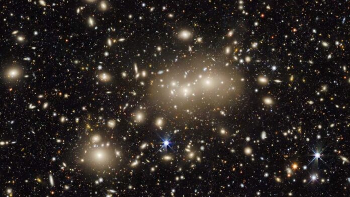
The largest two-dimensional map of the sky over Earth ever created just got even larger and is now covering almost half the sky over Earth.
The map created with data from a six-year-long pioneering survey of the cosmos features over a billion bright specks that represent galaxies, each containing billions of stars, according to the National Optical Astronomy Observatory (NRAO). (opens in new tab)
The expansion of the map comes thanks to the 10th data release from the Dark Energy Spectroscopic Instrument (DESI (opens in new tab)) Legacy Imaging Survey (opens in new tab). The aim of the project is to identify around 40 million galactic targets that can be used to precisely map the expansion history of the universe over the last 12 billion years.
These targets are used by the five-year DESI Spectroscopic Survey, a project that could help scientists finally understand dark energy, the mysterious force that is driving the accelerating expansion of the universe. This is a pressing mystery because, despite the fact that dark energy accounts for 70% of the universe’s total energy and matter content, scientists have little idea what it actually is.
Related: Black holes may be the source of mysterious dark energy
These targets have been selected for the DESI Spectroscopic Survey from this massive 2D cosmic map already and the project is underway, but that hasn’t stopped DESI scientists from adding to it to create the most comprehensive map of the sky they possibly can.
That means adding more images and incorporating better image processing techniques into the DESI Legacy Imaging Survey which already builds on the data from two earlier companion surveys: the Dark Energy Camera (DECam) Legacy Survey and the Beijing-Arizona Sky Survey.
Jointly these three surveys have imaged 14,000 square degrees of the sky over Earth’s northern hemisphere using telescopes at Kitt Peak National Observatory (KPNO) and Cerro Tololo Inter-American Observatory (CTIO) in Chile.
The 10th data release expands that coverage to 20,000 square degrees, nearly half the sky over Earth, by adding to the map DECam images of the sky over the southern hemisphere away from the glare of the Milky Way‘s bright disk.
In addition, the new data includes images of the sky with an additional filter that provides a view of the sky in near-infrared, just beyond the visible light spectrum that humans can see. As a result of increasing the map’s view of space and giving it increased wavelength coverage, it should now be useful to more scientists studying different celestial targets.
“The addition of near-infrared wavelength data to the Legacy Survey will allow us to better calculate the redshifts [the stretching of wavelengths of light via the expansion of the universe] of distant galaxies or the amount of time it took light from those galaxies to reach Earth,” CTIO astronomer Alfredo Zenteno, said in a statement. (opens in new tab)
The addition of near-infrared data means the data can be used to assist surveys that look at space using radio and X-ray wavelengths. This is because those investigations need a complete optical view to help track emissions back to clusters of galaxies or active supermassive black holes.
The data from the Legacy Surveys is publically available meaning amateur astronomers, as well as professional scientists, can access and use it to explore the universe.
“Anyone can use the survey data to explore the sky and make discoveries,” NRAO astronomer, Arjun Dey, said. “In my opinion, it is this ease of access that has made this survey so impactful. We hope that in a few years, the Legacy Surveys will have the most complete map of the entire sky, and provide a treasure trove for scientists well into the future.”
Follow us on Twitter @Spacedotcom (opens in new tab) or on Facebook (opens in new tab).

